Thanks to ongoing improvements in both platform and sensor technology, drones are becoming a much more viable platform for remote sensing tasks. While governmental organizations have traditionally utilized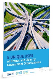 aircraft or on-the-ground personnel for their surveying needs, an increasing number of projects are employing drones equipped with lidar and other sensors to collect data. From road project planning and environmental research to uncovering ancient archeological sites, lidar and drones are providing a plethora of new data to government agencies.
aircraft or on-the-ground personnel for their surveying needs, an increasing number of projects are employing drones equipped with lidar and other sensors to collect data. From road project planning and environmental research to uncovering ancient archeological sites, lidar and drones are providing a plethora of new data to government agencies. This report details five case studies of government organizations who are utilizing drones and lidar to gain new insights. Among the case studies are:
• Using drones to map and visualize a hard-to-reach ancient site in a National Monument
• Improved surveying workflows for a complex road interchange project
• Mapping crucial marsh habitats in Natural Estuarine Research Reserves
• Pioneering and demonstrating sensors for river and water assessments
• Applying specialized lidar to aid a NASA carbon monitoring project
Download the full report to learn how drones and improved sensor technologies are transforming the work of NOAA, NASA, USGS, and more.
Presented by:

 hile drones are making a real difference for growers in the present, they are also opening up incredible opportunities for the future. This new report from
Connect with us